
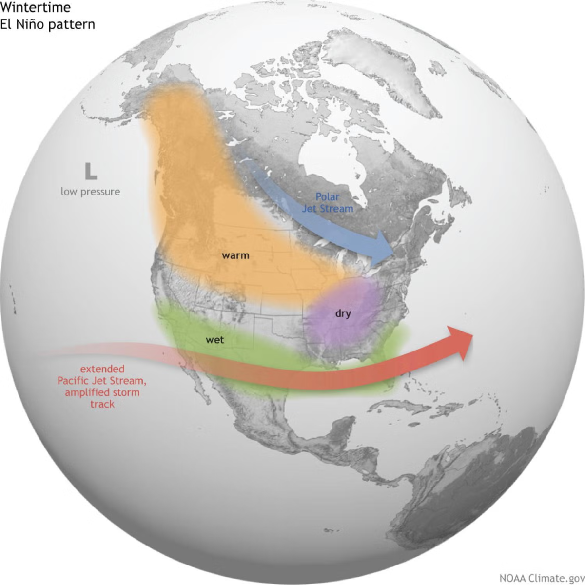


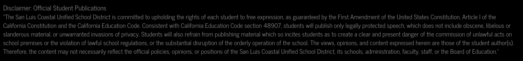


Scary predictions show the relationship between El Niño-affected wind patterns and changes in the weather. Image courtesy of NOAA.
The term “El Nino” is one historically associated with destruction. Meteorologists predict an El Niño period starting in the summer of 2026 and going into 2027. The question remains, what does this mean for San Luis Obispo residents and the central coast as a whole?
“I think I’ve heard about El Niños and that they can be kind of serious,” said senior Logan Yazzie. “Honestly, maybe it wouldn’t be so bad because we could use the rain.”
An El Nino is when the surface of the ocean increases to above 0.5 degrees above normal. Scientists estimate that ocean temperatures could rise to well over 2 degrees above normal this year, marking the beginning of what is widely (but unofficially) known as a “super El Nino”. Historically these periods of ocean warming were a cause for concern, but with weather patterns in constant flux as a result of climate change, predictability is a myth of the past.
“Our scientific understanding of El Niño has increased greatly in recent years. However, this event is playing out in uncharted territory. Our planet has altered dramatically because of climate change… So this naturally occurring El Niño event and human induced climate change may interact and modify each other in ways which we have never before experienced. Even before the onset of El Niño, global average surface temperatures had reached new records. El Niño is turning up the heat even further,” said meteorologist Michel Jarraud about the coming storm in 2016.
In a nutshell, the strength of trade winds and any given time dictate where the sun-warmed equatorial waters are carried. During El Niño, certain westward trade winds weaken, allowing that water to move northeast rather than northwest, resulting in warmer ocean temperatures in the eastern Pacific. The warmer ocean surface heats the lower atmosphere, causing convection. Not only does this convection locally increase the formation of tropical storms, but it disrupts the flow of northern hemisphere winds in a way that pushes those storms into the southwestern US and Mexico.
“There is no evidence that climate change increases the frequency or intensity of El Niño events. But it can amplify associated impacts because a warmer ocean and atmosphere increases the availability of energy and moisture for extreme weather events such as heatwaves and heavy rainfall,” said a writer for the World Meteorological Organization.
The central coast suffers neither the lack of moisture in the north nor the tremendous excess of it in the south, adhering to its reputation of temperance. However, this does not mean it will not see any increase in storm activity and rainfall. In past years, El Niños simply meant a bit more rain for the central coast, with the notorious destruction being restricted to further south. With that being said, the 26-27 El Nino could be of unprecedented scale and combined with the increasing unpredictability of climate change, temperance may not be a guarantee.